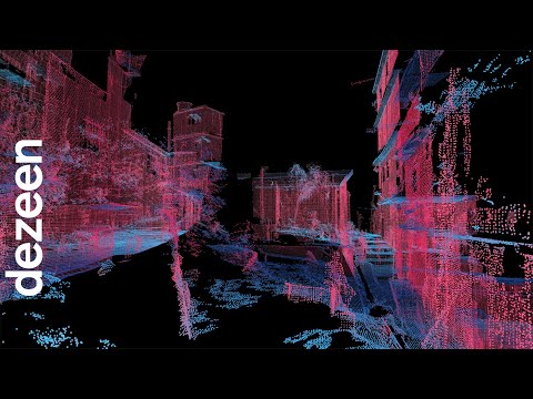
This one-minute video shows how MIT's @senseable_city_lab is using 3D laser scanning to analyse the architectural logic of Brazil's favelas.
Called Favelas 4D, the project used a 3D laser-scanning technique to record detailed virtual maps of the neighbourhood of Rocinha.
The project is a collaboration between MIT Senseable City Lab and architect ...
steven holl architects has designed a major new addition to princeton university?s growing campus in new jersey. the ?lewis arts complex? significant ...
SPACE International and design team Ground Up LA have built this dream home. For me this home is a perfect balance between a mid century, like a Neaut ...